Research & Collaboration

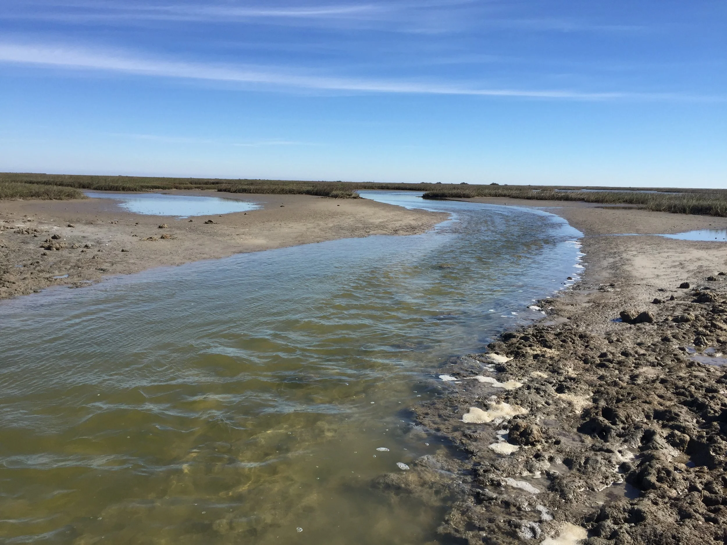
Matagorda Bay is a dynamic, ecologically rich estuary, and we believe science is key to understanding and protecting it. The Matagorda Bay Foundation is committed to supporting research that enhances coastal resilience, wetland restoration, and sustainable water management throughout the Matagorda Bay system.
We invite researchers, students, and institutions to partner with us in advancing applied science that informs conservation, restoration, and adaptive management.
-
We are particularly interested in supporting and collaborating on research related to:
- Freshwater Inflows and Estuarine Dynamics
- Understanding how flow regimes affect wetland health, salinity gradients, and bay productivity.
- Coastal Wetland Restoration & Monitoring: Evaluating the effectiveness of restoration actions on habitat quality, biodiversity, and ecosystem services.
- Hydrologic Connectivity: Studying how infrastructure and land management practices influence water exchange between tidal wetlands and open bay systems.
- Flood Risk & Nature-Based Solutions: Exploring multi-benefit strategies for reducing flood risks while enhancing habitat value.
- Understanding the transport mechanisms and impacts of plastics, forever chemicals, and chemicals of emerging concern, on estuarine and human health.
-
Whether you’re looking for a local partner, a field site, or real-world data, the Matagorda Bay Foundation can support research in several ways:
- Access to Sites & Local Knowledge: We manage or work on multiple coastal and wetland properties throughout the Matagorda Bay area.
- Data Sharing & Project Histories: Monitoring data and project documentation from past restoration efforts are available upon request.
- Joint Proposals & Grant Partnerships: We are open to co-developing grant proposals with academic or agency partners.
- Support for Student Projects: We welcome undergraduate and graduate students interested in research or internships related to coastal science, policy, or restoration.
Research Projects:
REMOTE SENSING FOR WATER QUALITY: HYDROLOGY AND TURBIDITY STUDY IN TEXAS BAYS
-
he Matagorda Bay Foundation is supporting an innovative research effort led by the University of Houston to advance coastal water quality monitoring through remote sensing technologies.
Purpose:
This project addresses the need for better tools to monitor total suspended solids (TSS)—a critical indicator of turbidity, water quality, and estuarine health—in Matagorda Bay and Trinity Bay. Accurately measuring and predicting TSS supports ecosystem protection, especially as coastal systems face increasing environmental pressures.
Approach:
Researchers are using hyperspectral satellite imagery to develop models that estimate TSS levels from space. These satellite-based predictions are validated with a range of ground-truth data, including in-situ reflectance measurements, direct water sampling, and historical datasets from USGS and NOAA. The study integrates these data sources to build a reliable framework for long-term monitoring.
Findings (in progress):
As this work is ongoing, early results indicate strong potential for satellite-derived tools to complement traditional field methods. The project is expected to produce predictive models that can support resource management decisions and improve the efficiency of water quality monitoring across large spatial scales.
Impact:
By enhancing our ability to detect and respond to changes in water quality, this project strengthens coastal resilience and helps safeguard the ecological integrity of Matagorda Bay, Trinity Bay, and other vital Texas estuaries.
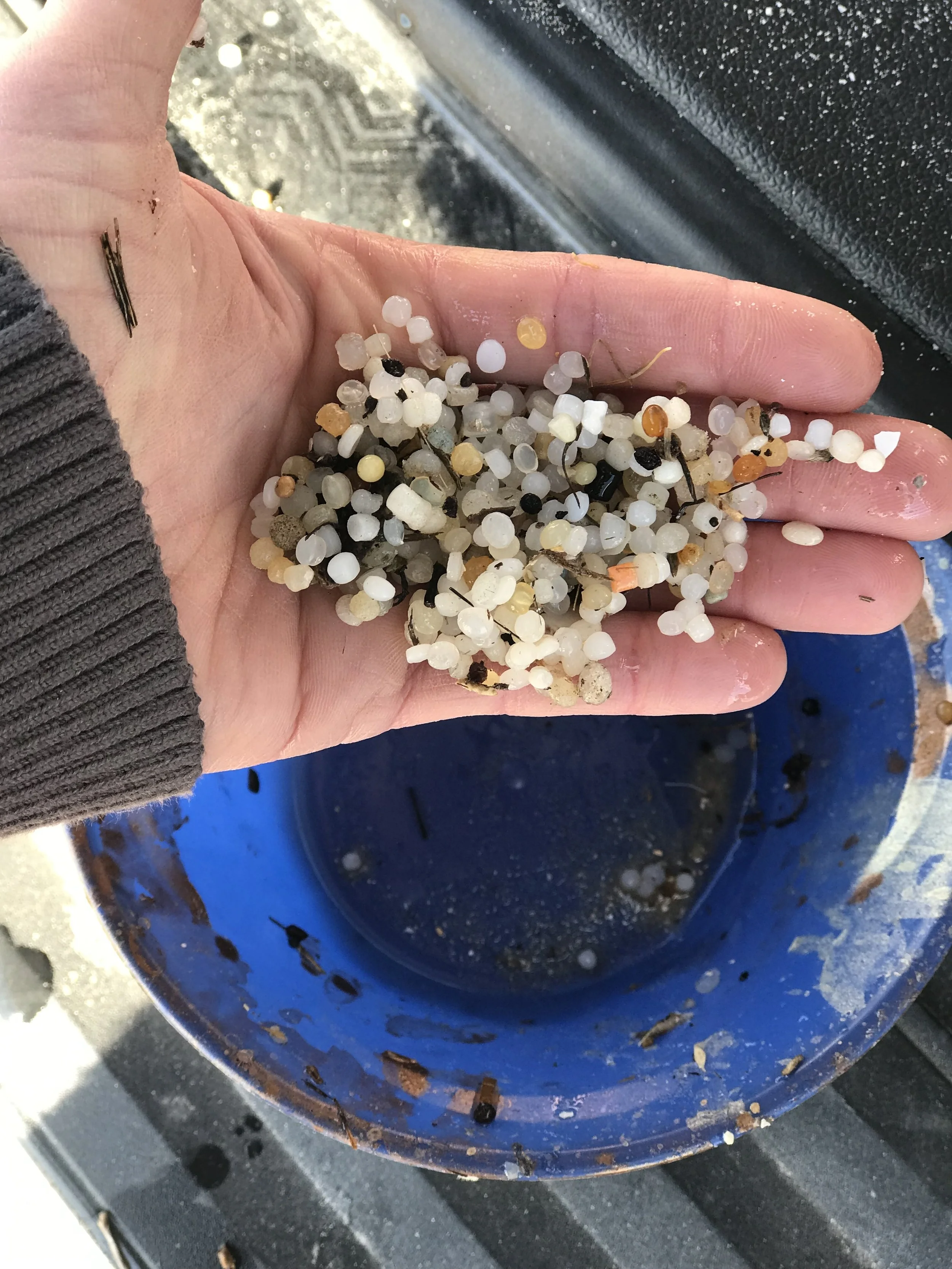
MICROPLASTICS AS A DISTURBANCE TO FOOD WEB DYNAMICS IN TEXAS GULF COASTAL BAYS
-
Elizabeth Everett, a graduate researcher at Texas A&M–Corpus Christi, completed a study on how tiny plastic particles—called microplastics—affected the food web in Matagorda Bay and surrounding coastal bays.
Why it mattered:
Matagorda Bay provides critical habitat for many species but faces growing pressure from plastic pollution. Everett’s research explored how microplastics, when eaten by small animals like copepods (tiny crustaceans), could move up the food chain to jellyfish and potentially other marine life. This “trophic transfer” of plastics can impact animal health and survival.
What was done:
With support from the Matagorda Bay Foundation and other partners, Everett collected samples from seven coastal bays, including East and West Matagorda Bay. She measured microplastic levels in water, copepods, and jellyfish larvae, and conducted lab experiments to see how microplastics influenced growth, behavior, and reproduction in these species.
Key findings:
The study found that microplastic concentrations were highest during the wet season, especially in areas with more freshwater inflow and visible litter. Animals exposed to microplastics—especially copepods—showed signs of stress, including reduced reproduction and slower development. Jellyfish exposed to microplastics retained them in their digestive systems and showed behavioral changes. This research helped fill important gaps in understanding how plastic pollution can affect Gulf Coast ecosystems—and provided valuable insights for protecting Matagorda Bay’s health and resilience.
SEISMIC MONITORING FOR COASTAL RESILIENCE AND ENERGY INFRASTRUCTURE PROTECTION
-
The Matagorda Bay Foundation is engaged in supporting emerging scientific leadership through the work of Johanna Villagomez, a Ph.D. candidate in geophysics at the University of Houston, whose research aims to advance seismic hazard monitoring along the Texas Gulf Coast.
Purpose:
With no current seismic monitoring network along the Texas coastline, this project addresses a critical gap in understanding regional fault activity and microseismic hazards. The Gulf Coast is home to vital energy infrastructure, carbon storage sites, and vulnerable coastal communities—making the need for baseline seismic data both timely and essential.
Approach:
Villagomez and her team are deploying compact, waterproof seismic nodes across a ~240-mile stretch of coastline from Corpus Christi to the Texas–Louisiana border. These nodes are buried shallowly (~12 inches deep) and pose no environmental risk. Notably, nodes have been successfully installed on the Matagorda Bay Foundation’s Dog Island property, expanding the project’s geographic and scientific reach. The array is collecting ground motion data related to offshore fault movement and ocean-generated seismic noise. Data servicing is required approximately once per month, with final deployment concluding in August 2024.
Findings (in progress):
While data collection is ongoing, the project is expected to yield the first regional dataset of background seismic activity in the Gulf of Mexico. This foundational information will support risk assessment, infrastructure planning, and coastal resilience efforts.
Impact:
This research not only contributes to public safety and energy infrastructure protection but also provides hands-on research experience for graduate and undergraduate students. Through her participation in the Seismological Society of America’s Geo-CVD policy fellowship, Villagomez is also working to bridge science and policy by advocating for coastal seismic monitoring at the state and federal level.

Interested in Partnering?
We’d love to hear from you. Whether you’re a student, researcher, or institution, please reach out to start a conversation about your work and how we might collaborate.